Posts

Showing posts with the label california

Meet your Mets: Senior Meteorologist Dustin
Image
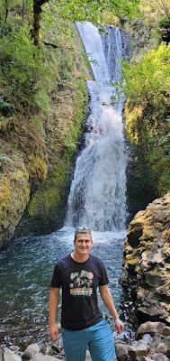
 Welcome Senior Meteorologist Dustin!  Dustin has been working at NWS Reno since October, and it has been great to have him back. Here's a little bit more about his NWS journey.  As a Florida native, Dustin has been fascinated by the weather from a very early age. His interest and inevitable career path were cemented by a few significant events during his childhood. In particular, 1998 stood out as a devastating year for Central Florida which saw both the deadliest tornado outbreak and worst wildfire season in Florida's history. Combined with the 2004 & 2005 hurricane seasons, Dustin was determined to work as a meteorologist with the National Weather Service. Shortly after receiving his B.S. in Meteorology from Florida State University with a Minor in Mathematics, Dustin began taking online courses to pursue a certificate in computer programming. During this time, he received a temporary Pathways Meteorologist position at the National Weather Service office in Reno, N...
Meet your Mets: Meteorologist Heather

Image
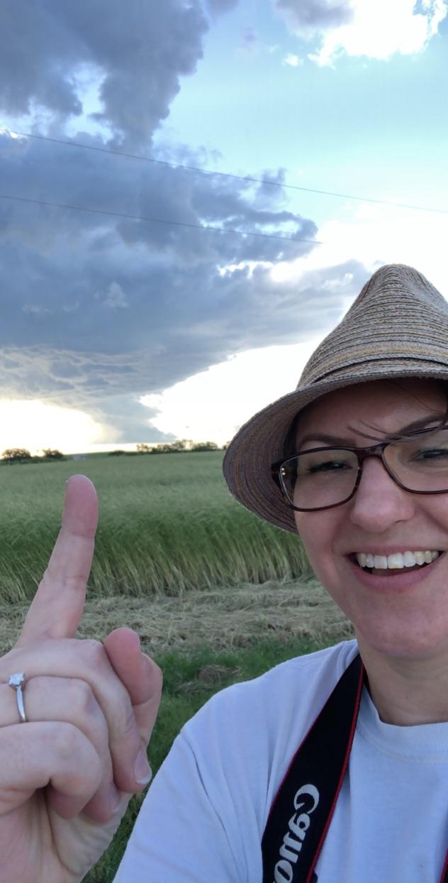
 We have had quite a few meteorologists and staff come and go over the years, so we figured it was time to introduce you to some of the newer forecasters. Heather has been working with us at NWS Reno since mid August and is quickly familiarizing herself with the quirks of eastern Sierra and Nevada weather.  Welcome to Heather!  Heather first became interested in meteorology as a child growing up in Michigan, witnessing many storms, floods, and winter events. Her family lived along a river in a flood zone, and had three separate occasions of complete inundation of their house. Her undergraduate degree in meteorology (Central Michigan University) and Master’s degree in geography (Ball State University) allowed her to study the hydrological and meteorological relationships responsible for the flood events that led to the inundations. Heather used GIS, hydrology, and meteorology to model flood behavior for flooding related to frozen versus unfrozen soil conditions. She was s...

Climate Newsletter May 2021

Image
(2-3) Image source:  https://climatetoolbox.org/tool/Climate-Mapper (4) Image source: nrcs.usda.gov (5) Image source: drought.gov (6-8) Images source:  https://www.cpc.ncep.noaa.gov (9) Image source:  https://rangelands.app/great-basin-fire (10) Image source:  https://www.ncei.noaa.gov (11) Image source:  https://mesonet.agron.iastate.edu/plotting/auto

Climate Newsletter January 2021

Image
Image source: Westwide Drought Tracker... https://wrcc.dri.edu/wwdt/ Red X = approximate location of Reno-Sparks. Percentile: 100th percentile (darker green) would mean an area had their wettest precipitation period as compared with past October-December or December periods in the climate record. 0th percentile (dark brown) would be the driest. Therefore, for the October - December period, most areas in eastern CA and western NV received precipitation in the lowest 1/3rd of other October-December periods in the climate record.

East Wind Events: Windy Up "There", Not-So-Windy Down "Here"

Image
Gusty Ridges, Calm Valleys.  We have gotten a lot of questions lately about why it's so windy up in the mountains and why there are  no winds down in the valleys, so we figured we would write up a quick blog post about it. Let's talk  observations...these are just a spattering of observations from an event we had this week  (Dec 6-8, 2020). Notice the big difference between the ridges and the valley locations.  Let's not get stuck on the actual numbers at the ridges, since some of those sensors can get a little 'off' once wind speeds really pick up, the more important thing to note is the large differences in the wind  gusts from ridges to foothills to valleys. (note obviously Peavine was having a bit of trouble too)  We want to dig into how this occurs and why it happens! So if you're brave and ready for some science,  then continue onward. General Weather Setup  It is a well known set up and similar to previous events, but the magnitude of...

Climate News - September 2020

Image
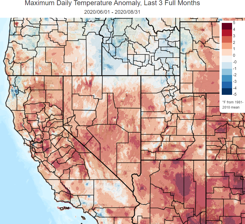
Hope everyone has been doing as well as possible! For this newsletter, we will begin with the usual summary of regional climate features over the past few months. That will be followed by a look at abnormally warm ocean waters, also known as a “marine heat wave”, which have set up across the North Pacific. Finally, we’ll throw in a few words about climate averages from The National Centers for Environmental Information which are due to be updated by the middle of next year. Note: If you have any questions or would like clarification on what is presented in this newsletter, feel free to message us on Facebook ( https://www.facebook.com/NWSReno/ ) or email w-rev.webmaster@noaa.gov ________________________________________________________________________________ So, what’s been happening from a climatological perspective across northeast California, the Sierra, and western Nevada? Summer high temperatures ran considerably above average when compared with the averages from 1981-2010 (the la...

Climate News - April 2020

Image
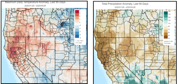
  CLIMATE NEWS April, 2020 Hello folks! The National Weather Service in Reno hopes you are doing well during these unusual times.  This will be the first edition of a periodic newsletter that will contain summaries of various aspects of the climate, mainly across northeast CA, the Sierra, and western NV but sometimes on a continental or global scale.   NOTE : if you have any questions or would like clarification on what is presented in this or future newsletters, feel free to shoot us a message on Facebook ( https://www.facebook.com/NWSReno/ ) or email w-rev.webmaster@noaa.gov Alright, let’s start with a summary of the recent precipitation and temperature trends around the region. Here are a couple maps showing that the region has generally been warmer than average temperature-wise (+1.6 degrees at Reno) with well below average precipitation (48% Reno) since late January. Source: https://climatetoolbox.org/ The notable lack of precipitation has led to a below average...