Hiking in the High Sierra? Attn: PCT through hikers!
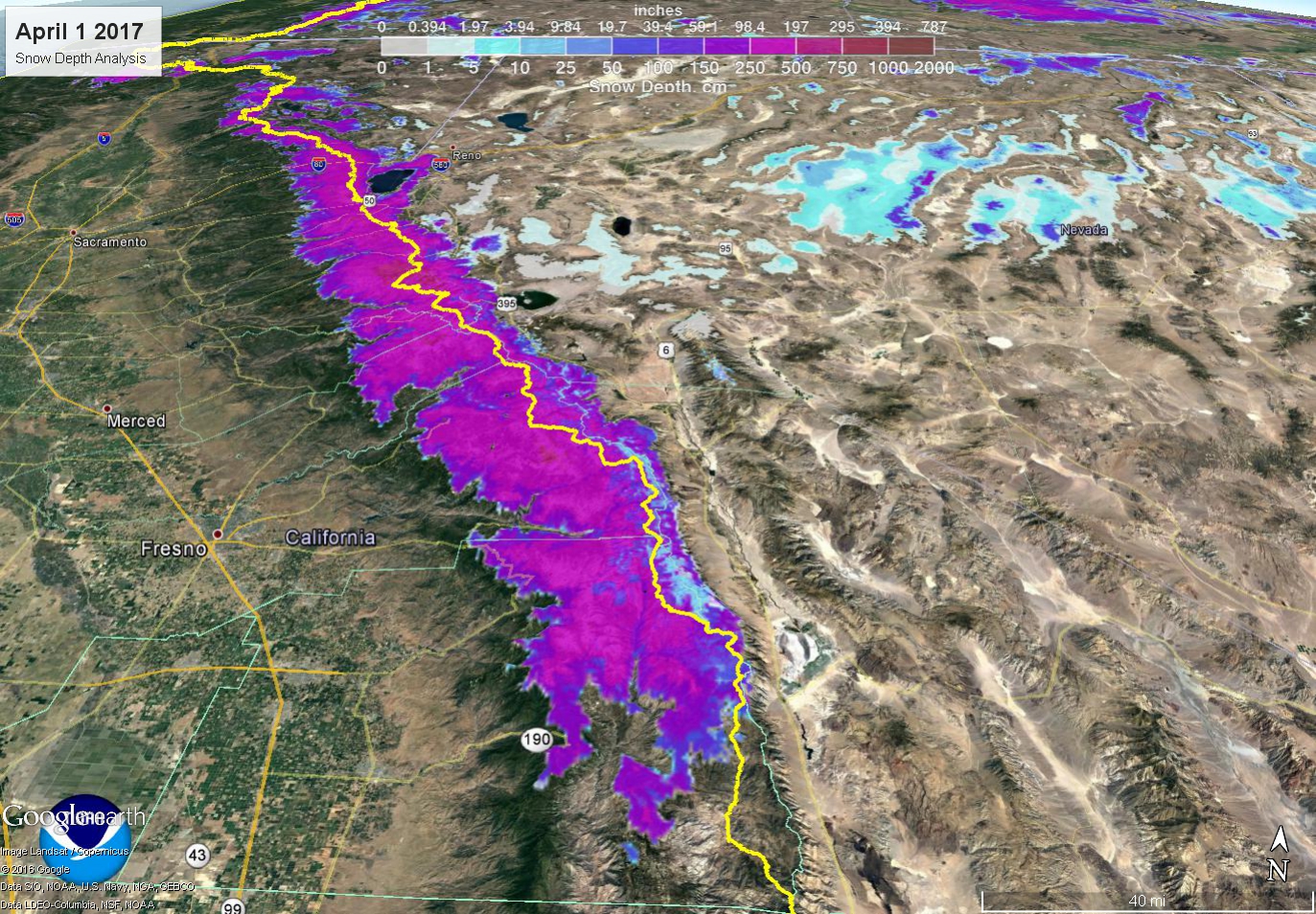
Let's Talk Total Snow Amounts Our reliable snowfall measurement sites in the Sierra, certainly near the PCT, are very limited. So it would be better to show a map of snow depth using automated sensors and satellite data. This was taken on April 1, typical peak snowpack date. Values of 16-25 feet were fairly common along the PCT from near Tahoe to southwest of Bishop! Here’s June 8th's plot for comparison Yellow line = PCT Mammoth Mountain in January alone received 20.5 feet of snow, earning the month the Twitter hashtag #januburied. Of course snowfall was variable, but on a big picture this was a particularly impressive season for the Sierra from Tahoe to Bishop. The section between Tioga/Tuolumne and Sonora Passes got particularly crushed . That’s where some of the deepest snowpack still exists. A snow measurement by Jeff Anderson, NRCS, and Tim Bardsley, NWS, made just Tuesday at Leavitt Lake near Sonora Pass - 15 feet deep, containing 102.5 inches of water conte...