How Are National Weather Service Storm Reports Used?
For many years, the National Weather Service (NWS) has relied on spotter/public storm reports to help in the issuing of critical weather statements, verifying warnings and advisories, and to document the impacts of weather on life and property. In recent years, posts on Facebook and Twitter which contain photos or videos have helped to streamline the event verification process across northeast California and western Nevada. Remember, "a picture (or video) is worth a thousand words!"
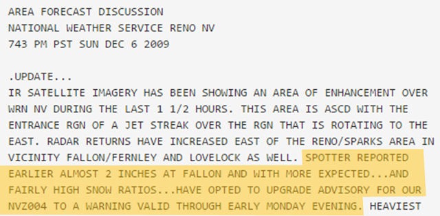
So...what are some of the ways NWS storm reports are used and distributed? Most immediately, storm reports help NWS forecasters decide whether to update the forecast or issue a statement...
as can be seen from the Area Forecast Discussion below.
A second use for storm/spotter reports is verification of National Weather Service watches and warnings. Below is a map with NWS warnings (red boxes) overlaid with storm reports. Besides helping forecasters glean whether or not warnings were warranted, verification can aid forecaster training for future events by combining recognition of a weather pattern with what actually occurred based on the storm reports. In other words, spotter reports are very critical to the mission of the National Weather Service of protecting life and property.
A third use for storm reports is dissemination to government officials, scientists and the general public for various purposes. This includes (but certainly not limited to) research, financial concerns and for general public interest.
So...what are some of the ways NWS storm reports are used and distributed? Most immediately, storm reports help NWS forecasters decide whether to update the forecast or issue a statement...
as can be seen from the Area Forecast Discussion below.
 |
| Storm Reports and Warnings July 1 - 7, 2015 |
A third use for storm reports is dissemination to government officials, scientists and the general public for various purposes. This includes (but certainly not limited to) research, financial concerns and for general public interest.
**In case you are interested, here are a couple of links to storm report sites (there are many more!).
- The National Climatic Data Center's Storm Events Database (used to make the Storm Data publication...delayed several months).
- The Storm Prediction Center's Storm Reports (preliminary data...more recent info available)


